Courland of Latvia

Courland (Western Latvia): Cities, Towns and Sights

Courland

Courland (Latvian: Kurzeme) covers the entire Western shore of the nation. It is sparsely populated and has a strong ethnic Latvian majority (75,9%), mostly Lutherans.

The region‘s rugged empty beaches are joined by two port cities: Liepāja and Ventspils, where stately buildings remind of past importance. In the 17th century, the Dukes of Courland dispatched colonists to America from these cities, using a navy that was 1/3rd of the legendary Spanish Armada. 200 years later there was a Liepāja-New York direct steamship service as the old ports were revitalized by railways.
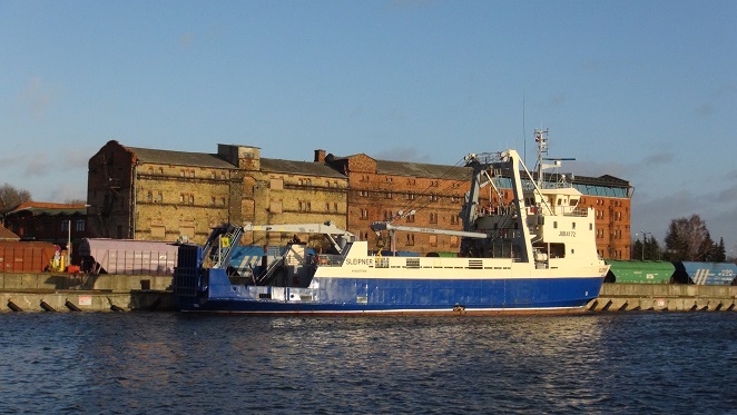
Historic port warehouses in Liepāja
Historic port warehouses in Liepāja. ©Augustinas Žemaitis.

The ports are still extremely important, but Courland has also used its uncrowded seaside to attract tourists. Good modern tourist infrastructure and entire districts of 19th-century wooden villas built for the elite of the day are both a reminder of that.
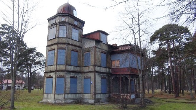
An abandoned villa
An abandoned German villa in Ventspils. ©Augustinas Žemaitis.

Courlandian hinterland includes multiple pretty towns: Kuldīga, Talsi, and Kandava. Smaller than the cities they seem to be just as old. Many of the pretty buildings have been constructed by Germans, who were the local lords and made 15%-50% inhabitants in most cities and towns until the 20th century.
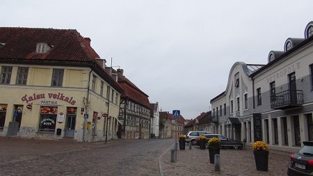
Main square of Kuldīga with old brick buildings, typical for Courland main towns
The main square of Kuldīga with old brick buildings, typical for Courland main towns. ©Augustinas Žemaitis.

In the 19th century, Courland served as the westernmost land of former enormous Russian Empire, making it a natural military outpost – and now a great location for exploration by military buffs. Liepāja hosts an entire „military city“ of Karosta, where Imperial Navy was once stationed. Soviets too left their crumbling installations, such as Skrunda-2 military town (now abandoned) or a massive radar near Ventspils.
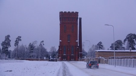
A tower in Karosta of Liepāja
A tower in Karosta of Liepāja. ©Augustinas Žemaitis.

Luckily, Courland was saved from Soviet destruction during World War 2. Nazi Germany held Courland until its leaders surrendered. That is, Soviet flag was already waving over Berlin but German troops still guarded Liepāja and Ventspils. Therefore Courlandian cities and towns remain much as they did before the war, with pretty brick buildings and elaborate wooden contraptions.

The lack of post-war growth also helped to conserve the looks: Courland today has as many inhabitants as it had before World War 2, so there was little modern construction. The towns and cities are surrounded by pristine nature, such as at the northernmost tip of Courland known as the Liv Coast, famous for its unique Liv indigenous minority. Courland forms the bulk of Latvian shoreline.
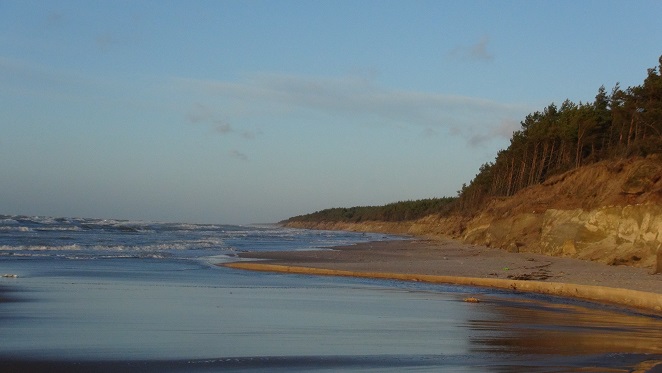
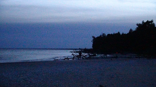
Steep sandy shores are common in Western Courland
Steep sandy shores are common in Western Courland. ©Augustinas Žemaitis.

Liepāja

Liepāja (pop. 77 000) is the westernmost Latvian city. For centuries it has been a major seaport and competed for the status of Latvia’s second city.

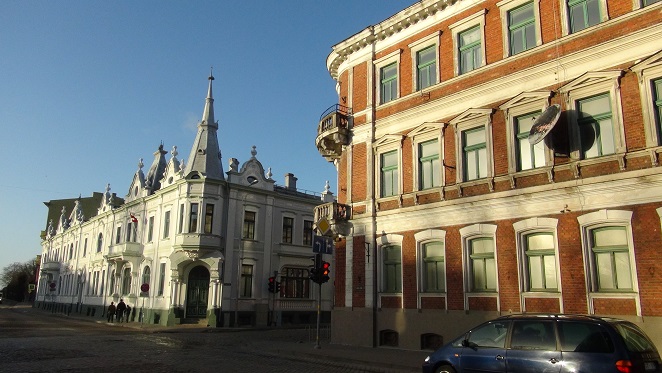
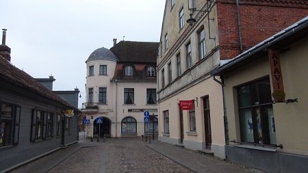
As Liepāja has less inhabitants today than in it did in 1911, the “new” is is still overwhelmed by the old. To this day Liepāja is full of picturesque turn-of-the-20th-century buildings when the city was a major naval hub of the Russian Empire, being important to many ethnic groups.

Picturesque buildings in Liepāja Old Town
Picturesque buildings in the Old Liepāja. ©Augustinas Žemaitis.

Liepāja consists of three parts, separated from each other by old shipping canals:

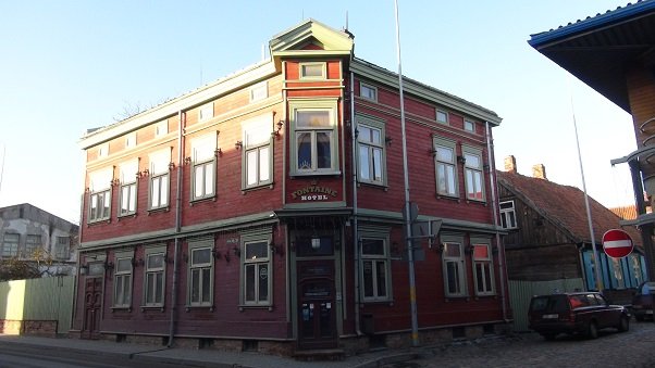
The southernmost is Old Liepāja is the historic downtown with old churches, art nouveau edifices and hundreds of wooden apartment buildings. It was here where Liepāja’s original glory began in 17th century when it took part in the colonization of Americas and Africa. Little of that era remains, having been replaced by 19th century, when rapidly expanding city needed to house the Latvian and Lithuanian workers as well offer seaside places to build villas for the German elite. Old Liepāja continues to be the main hub of nightlife and is considered the downtown.

Typical wooden building of Old Liepāja
Typical wooden building of Old Liepāja. ©Augustinas Žemaitis.

New Liepāja is the geographic center of Liepāja that hosts its bus and train stations. It offers some shopping and entertainment opportunities. Developed in the 19th century it also has some pretty buildings, however, it is not usually treated as a tourist sight.

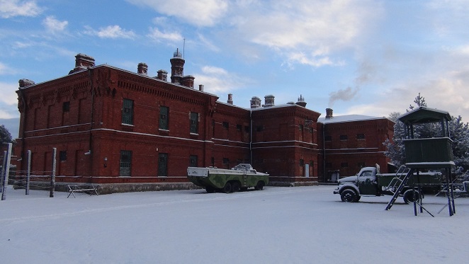
In the north Karosta is becoming Liepāja’s symbol in spite (or likely because of) being mostly abandoned. That was an entire military city of the Russian Empire that hosted tens of thousands soldiers and officers in its now-crumbling red-brick buildings.

Karosta prison in Liepāja
Karosta prison. ©Augustinas Žemaitis.

Liepāja is surrounded by sea and lakes. Grobiņa suburb has a lakeside castle ruins and Viking graves.

Loading map...

Loading

Kuldīga town

Kuldīga (pop. 12 000) is one of the most atmospheric towns in Courland and Latvia.

Kuldīga famous for its picturesque old town with 17th-18th centuries riverside buildings. As the town population today is similar to that before World War 1, and the destruction witnessed minuscule, nearly all buildings in the Old Town are at least a century old.

Main streets both for enjoying old buildings and activities are Liepajas (pedestrianized) and Baznicas. The main City Hall square is between them.

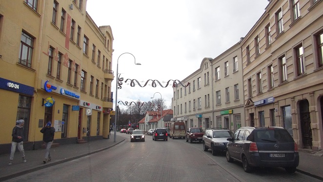
Kuldīga downtown
Crossing the Liepajas street in Kuldīga downtown. ©Augustinas Žemaitis.

Kuldīga once served as a major center of the Livonian Order and then Duchy of Courland and Semigallia, but the castle did not survive and has been replaced by a Castle park. Only some cellars have been reused by the Kuldīga museum. The museum operates in a large wooden building that has been brought in from EXPO 1900 in Paris where it served as Russian pavillion. Playing cards of the world are also exhibited there.

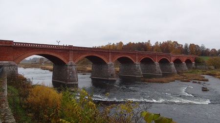
Kuldīga has the Europe’s widest waterfall (width 249 m) known as Ventas Rumba. However, it is only 2 m in height. Downriver from the falls Venta river is crossed by a historic brick bridge (1874), one of the longest surviving brick bridges in Europe. A disused water mill provides more scenic water views with its 4,5 m tall dam.

Kuldīga old bridge
The brick bridge of Kuldīga. ©Augustinas Žemaitis.

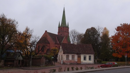
Among the old small buildings of Kuldīga stand rather massive houses of worship of four religions: St. Catherine’s Lutheran, St. Ann Lutheran, Holy Trinity Catholic, Russian Orthodox (built under Russian rule in 1871 when Orthodoxy was promoted). Synagogue is now closed and hosts a city library.

St. Anne Lutheran church
St. Anne Lutheran church is the largest among Kuldīga churches. ©Augustinas Žemaitis.

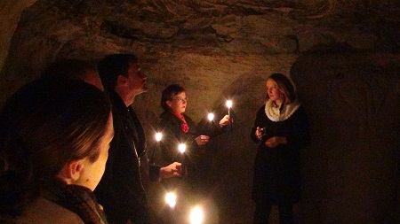
The forest 5 km north of Kuldīga has Riežupe “sand caves” underneath. Originally excavated in order to get high quality sand they are now used for tourism. Candle-carrying excursions visit a quarter of 2 km cave labyrinths; various attractions are offered. The caves are closed in winter for hibernating bats (some of them come to sleep earlier and may be seen).

Kuldīga sand caves
Kuldīga sand caves. ©Augustinas Žemaitis.

Ventspils

Ventspils (pop. 39 000) is a massive port and the commercial hub of northwestern Latvia (Courland).

The docks are seamlessly integrated into city downtown, ships mooring right next to the historic buildings, never allowing one to forget that this is one of the Baltic Sea’s largest ports.

Ventspils main square with Lutheran church
Ventspils main square with Lutheran church. ©Augustinas Žemaitis.

Such status is impressive, given the city’s small population. Still, in the gone-by eras the influence of Ventspils was even greater, as it was the naval heart of Courland-Semigallia duchy that partook in the colonization of Americas and Africa.

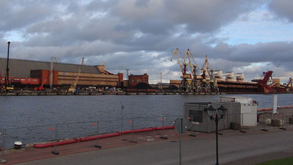
Ventspils port buildings as visible accross the river from Old Town
Ventspils port buildings as visible accross the river from Old Town. ©Augustinas Žemaitis.

Ruled by a single mayor Aivars Lembergs since 1988 Ventspils has been keen on establishing itself as a “pretty city” worth travelling for.

It boasts some of the Baltic States’s nicest landscaping: “flower sculptures” (in summer), decorated cow statues. Even prosaic buildings (such as port warehouses) are well illuminated, arguably surpassing even Riga in that sense.

One of Ventspils cows in front of the port administration building in Old Town
One of Ventspils cows in front of the port administration building in Old Town. ©Augustinas Žemaitis.

The most unique Ventspils publicity stunt is the Vent currency. It is possible to “earn” it virtually by doing various online activities (such as answering quiz questions about Ventspils). The banknotes may then be withdrawn from account once in Ventspils, and may be used to pay (in part) various local expenses such as museum tickets.

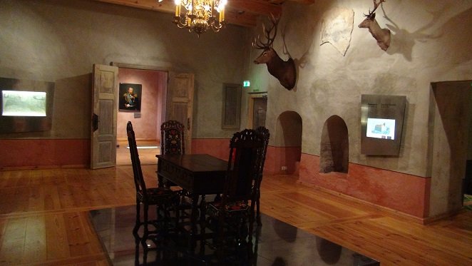
Livonian order castle interior, representing eras gone-by (partly payable by Vents)
Livonian order castle interior, representing eras gone-by (partly payable by Vents). ©Augustinas Žemaitis.

Much of Ventspils attractions are located in Seaside Ventspils. Built up in 19th century with elaborate wooden villas and homes, the area has been successfully repurposed for modern seaside tourism.

One of the historic Ventspils villas
One of the historic Ventspils villas. ©Augustinas Žemaitis.

The wide sandy beach is far from the only attraction of Ventspils and the city is regularly constructing new ones. Among them is the artificial hill for skiing (creating one was a big task in lowland Latvia). It is located in the Soviet districts which, together with suburbs, also have interesting historic sights, such as a massive Soviet radar.

One of the main streets of Old Town Ventspils
One of the main streets of Old Town Ventspils. ©Augustinas Žemaitis.

Liv Coast (Slītere NP)

Liv Coast covers the northwestern tip of Latvia. This forested thinly populated area is notable for its animals and pristine nature, organized into a Slītere National Park.

However it is arguably even more famous for its indigenous population, the Livs (Livonians). They used to speak a language very different from Latvian. Unfortunately, assimilation made the language to disappear (the final native speaker died in 2013), but the remaining Livs still cling onto their heritage (a Liv community home stands in Mazirbe village). Government policy discourages settlement of non-Livs in the area as well as opening tourist institutions, hoping that by limiting outsider influence more of the Liv culture could be saved (although this policy may have came too late).

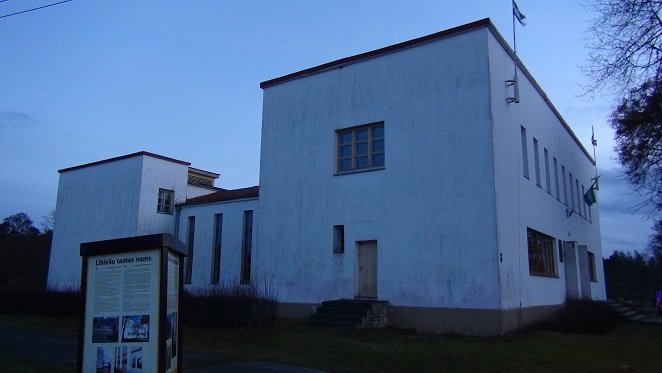
Liv community house in Mazribe, one of historic Liv villages, opened in 1938, is one of the few remaining Liv institutions
Liv community house in Mazribe, opened in 1938, is among the the few remaining Liv institutions. ©Augustinas Žemaitis.

The line of Liv villages ends in the Cape of Kolka. It is a popular location for camping and fishing. It is also interesting to stand at the cape and look back at two very different coastlines: one with a large beach on the northern bank and a constantly eroded one at the western bank (more and more trees fall into the sea every year). Parking near Kolka cape is paid and somewhat expensive, however.

Trees getting washed as the sea slowly erodes the shoreline near Cape of Kolka
Trees getting washed as the sea slowly erodes the shoreline near Cape of Kolka. ©Augustinas Žemaitis.

Talsi town

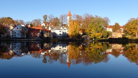
Talsi (pop. 11 000) is a town in Courland famous for its location on nine hills that surround two lakes. The lakes reflect old homes and are adorned by a fountain in summer, while the hills provide great vantage points (although most are covered by trees in summer).

Old Town of Talsi
Old Town of Talsi resplending in a lake with the Lutheran church above. ©Augustinas Žemaitis.

The Old Town has many old buildings. Liela street is the old main street. The crude-looking Lutheran church (1567) stands on a nearby hill providing the pinnacle for Talsi townscape. It once served as the heart of the town.

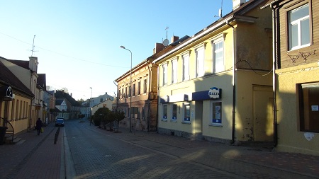
Talsi Main street
Liela street, the old high street of Talsi. ©Augustinas Žemaitis.

The current main streets are Krišjāņa Valdemāra and Brīvības which are wider than Liela but still historic.

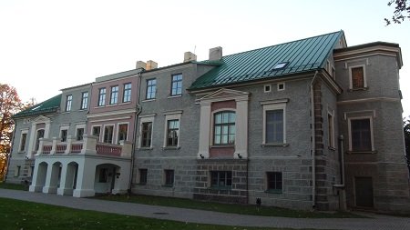
Further from the center Firck Palace, built by Baron von Firck (one of the German nobles who effectively ruled Courland well into 20th century) in 1883 now houses Talsi regional museum. Open-air scene for concerts is nearby.

Manor of Talsi
Firck Palace in Talsi. ©Augustinas Žemaitis.

Skrunda-2 Soviet ghost town

Skrunda-2 is an abandoned Soviet military town which hosted ~5000 inhabitants. It is one of the most easily accessible abandoned towns in the world.

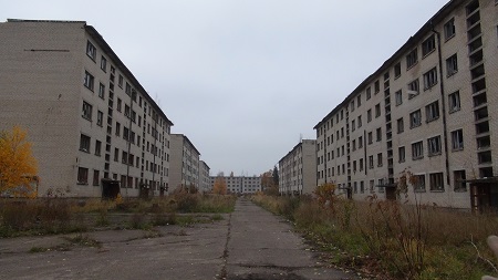
Skrunda-2 main street
Overgrown main path of Skrunda-2, surrounded by Soviet apartment blocks of 1960s. ©Augustinas Žemaitis.

During the Cold War Skrunda-2 it served a radar base to track Western space communication and possible nuclear missile launches.

While the radars themselves have been destroyed as Russian soldiers retreated in 1998, the former residential buildings, school, water tower, officer’s Club and other installations remain.

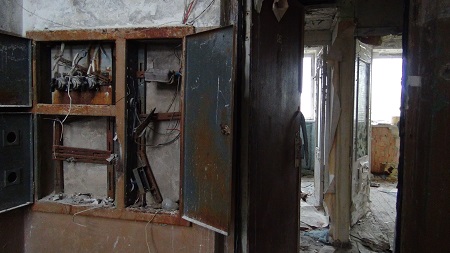
Skrunda-2 residential building interior
Ransacked interior of residential building with interiors of flats visible. ©Augustinas Žemaitis.

The ability to access Skrunda-2 tends to change almost every yeat. Initially after the closure, Skrunda-2 used to be guarded (although the rampant corruption and vast area meant there were increasing numbers of urban explorers who still managed to gain access). Later it became unguarded and, even though technically prohibited to enter, it attracted even more tourists, up to ~50-100 people at any given time every summer weekend. At 2016, it became officially legal to enter, but a fee had to be paid at the entrance. At ~2018 the entrance was formally banned once again and, according to the recent reports, Skrunda-2 is now inaccessible.

Unfortunately, vandals have came together with visitors, leaving no windows in Skrunda-2 intact
Unfortunately, vandals have came together with visitors, leaving no windows in Skrunda-2 intact. ©Augustinas Žemaitis.

What makes Skrunda-2 especially appealing is the fact that all the doors are left open, allowing full exploration (including basements, roofs, etc.). While anything of value has been removed (e.g. metal radiators), many small mementos of the life that used to go on there remain (e.g. somebody’s collection of bubble gum stickers). While the town was within Latvia it was mainly Russian, as evidenced in Russian-only inscriptions and newspapers.

It is advisable to walk carefully as there may be some open shafts.

Skrunda officers club
Partly burned out Skrunda-2 officer’s Club with Soviet five-pointed star decor. ©Augustinas Žemaitis.

Kandava town

Kandava (pop. 4000) is a small town in Eastern Courland, famous for surviving the wars almost intact.

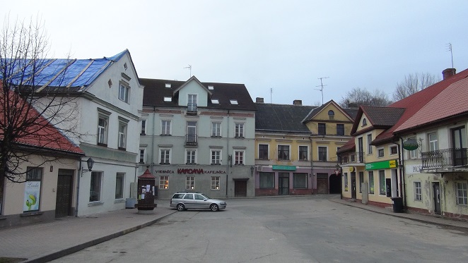
Market square of Kandava
Market square of Kandava. ©Augustinas Žemaitis.

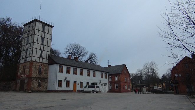
It offers a glimpse of how a pre-WW1 Latvian town looked like. The main market square is surrounded by old buildings: residential, commercial and an old fire fighter depot. A couple of nearby streets are equally old.

Firefighters depot in the Market square
Firefighters depot in the Market square. ©Augustinas Žemaitis.

Three religions have their houses of worship in Kandava: Lutheran hilltop church, Roman Catholic and Jewish (the Catholic church is however new while the synagogue is closed).

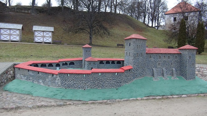
As it was common in the 19th century, the town has a ruined Livonian Order Castle on top of one of its hills. It has been neither completely dismantled for building material, nor rebuilt as happened elsewhere. A model located at the foothill helps re-imagining how the castle looked like when intact.

A model of Kandava Castle under the hill where the ruins of the original one remain
A model of Kandava Castle under the hill where the ruins of the original one remain. ©Augustinas Žemaitis.

Another draw to Kandava is its 1873 stone bridge, the oldest in Latvia.

Sights, Cities, History, Culture and more